New work led by Gina Lovasi and Steve Mooney was published in the American Journal of Public Health looking at the effects of building density and tree canopy cover in NYC on the accuracy of GPS data for measuring distances traveled while walking. GPS way point data were collected using GPS loggers during structured walks in high and low building density and high and low tree cover streets. The work shows that measures of distances traversed estimated from successive GPS way points tend to overestimate actual distances walked, and more so in areas with high building density and high street tree coverage.
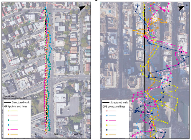
GPS data captured during walks on low and high building density streets. Images by Daniel Sheehan