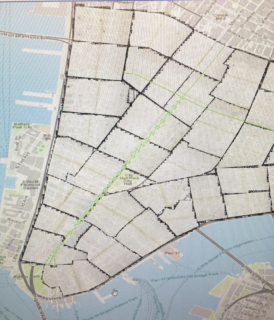
This week I started working with base maps for my final project. I ended up choosing Perris’ “Maps of the City of New York” (1852-54). I chose this maps because it was the most comprehensive map that I could find that worked with the time period of my project. The only limitation of this map is that is only goes up to 42 Street, but I don’t think this will be a problem. I started my project by downloading the georeferenced maps from NYPL. Then I began to work out the best way to go about mapping gas lamps. Using Common Council reports, and reports from the Board of Assistants and the Board of Aldermen, I have gathered data that provides information on where gas mains and lamps were installed in Lower Manhattan. From the reports I have learned that by February 1836, there were a total of 6232 public lamps extending over 107 miles in Manhattan. Of these 6232 public lamps, 668 of these were lit with gas. These reports provide street names where gas lamps were installed, and occasionally provide information on the number of lamps installed on those streets. The reports also state that gas lamps were generally installed every 80-100ft. Over the past week, I have mostly been troubleshooting and trying to come up with the best system to map lamps. I started with Broadway, as gas lamps were first installed along Broadway from Battery to Grand street in 1825. From the reports, I knew that there were 120 gas lamps along this stretch of Broadway. In the first map I created, I placed gas lamps (each marked by a point) on each corner along both sides of Broadway from Battery to Grand Street. This came out to a total of of 96 points. I then added gas lamps to the middle of the blocks that were particularly long. By doing this, I was able to reach a total of 120 points. The map I created seems to be the most feasible in terms of where lamps were likely placed along Broadway, but I want to experiment a bit more and try mapping these lamps in a different way. I tried to use the split feature to divide a line, which ran on Broadway from Battery to Grant, in 100 ft increments. However, I was having trouble getting this to work. I feel confident though that I can map gas lamps on other streets besides Broadway by primarily placing lamps on street corners, as intersections are the most common location to find lamps.