Page 5 of 5

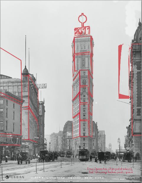
In just the last decade, New York has changed to an astonishing degree. Just ask Columbia urban planning alumnus Tom Lunke. For the past 12 years, the class of ’95 grad has been the planning director of the Harlem Community Development Corporation, where he has witnessed first hand the evolution of the neighborhood and been an insider in some of the more heated public debates, including the Manhattanville expansion plan.

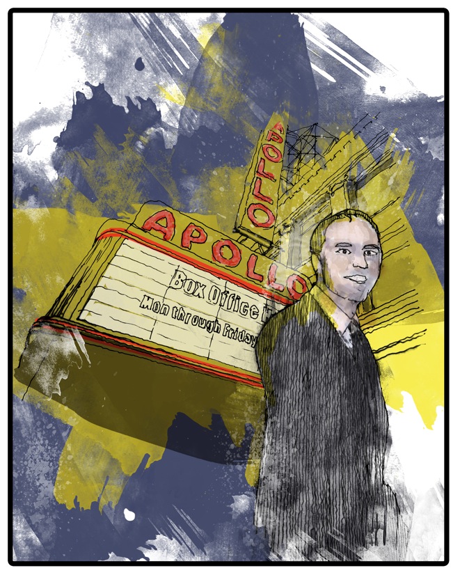
URBAN met with Lunke to hear about his experiences in Harlem.

URBAN: What kind of work have you been doing with the Harlem Community Development Corporation (HCDC)?

Lunke: I’ve ended up doing a lot of public space projects dealing with either creating new space or expanding old space or redesigning it in some way with the community’s input.

URBAN: Have you built good relationships with the community as director of the HCDC?

Lunke: When I first came here, people looked at me like I was from Mars. There were very few white people in Harlem at that time, and it was under a republican administration so they thought, “ok, here’s a republican coming in and he’s not necessarily going to care about what our needs are.”

So I worked really hard to basically turn that myth on its head and show that I was here for them and that basically I could be a conduit between the interests downtown and their interests, and that I would be an honest conduit.

URBAN: Have you witnessed much change in Harlem since you first began working?

Lunke: Oh yeah. When I first came here [twelve years ago] it was really something else. There was still a lot of poverty. I mean, now you see poverty in the people on the street, especially on 125th street. But when I first came here you saw a lot of the physical poverty in the structures.

You would go walk down a street and smell mold, because there
were so many buildings that had been left abandoned that they were basically molding. So there was a very kind of musty smell on many of the side streets. You don’t have that any more because so much of these streets have been redeveloped.

URBAN: If I remember correctly, HCDC opposed Columbia’s Manhattanville expansion plan that called for the use of eminent domain which was ultimately approved by the State Supreme Court. How do you look back on that experience?

Lunke: That was a real struggle. What was clear from the beginning was that Columbia was only interested in acquiring all the property for what is essentially a 17th century campus plan. What we tried to get them to think of was…a Columbia of the 21st century, where their project would be integrated into the fabric of the existing community.

URBAN: What do you mean by 17th century?

Lunke: The plan for the future campus in Manhattanville…is essentially a quad with buildings around it. And the way it’s built, even if they have streets going through it, psychologically it’s an isolating campus.

We [the HCDC] asked them to look at not acquiring all the property, but leaving those businesses that wanted to remain and being aware that there are independent voices within this larger context so that land isn’t controlled by a single entity and is therefore making a single decision.

URBAN: So something with a greater mix of uses, essentially?

Lunke: They were talking about…the importance of interdisciplinary dialogue. What I tried to explain to them is that interdisciplinary dialogue isn’t just one department talking to another, but it’s a department talking to the outside world and getting ideas to apply within the department.

If Columbia wants to be at the cutting edge, [it needs to speak] with people who are on the streets. Not all the greatest ideas come from above and go down. You can get the reverse. And so if we’re talking about a creative economy, well, that involves everybody; everybody thinking and discussing and comparing.

By Jake Schabas

Space is both devoid and charged with meaning. Elements of the built environment suggest uses, and cultural norms protect their sanctity. In our society, a sidewalk connotes pedestrians, a roadway cars, and a dog run dogs.

While these spaces have clearly defined purposes, they are not immanent or immutable.

The revolutionary uprisings that have engulfed the Middle East and North African region demonstrate their malleability. Tahrir Square in Cairo is the most prominent example of how a space, once the crown jewel of Egyptian tourism and public life, was quickly converted into a site that fomented the ouster of the country’s ruler, Hosni Mubarak.

Cyberspace, specifically Facebook and Twitter, may have received the credit for catalyzing these revolutions, but public spaces have been the true battlegrounds. While one might convincingly argue that these revolutionary spaces resulted from calls to demonstrate from cyberspace, without a physical place to assemble, it’s impossible for people to unite and attempt to depose their rulers.

The example of Bahrain stands out from the other uprisings because it has no Tahrir squares. According to media reports, Manama, the capital city, lacks public spaces altogether.

Without space to assemble, Bahrainis were barred from protesting their government. Undeterred, Bahrainis took their fight to the streets: they transformed a mundane piece of road infrastructure into a site suitable for revolution.

The Bahrainis decision to redefine the purpose of Pearl Roundabout and Monument was a stroke of genius that revealed how easily space could be reprogrammed, redefined, and reinterpreted. By removing drivers from the roadway, the roundabout was no longer recognizable as a place for cars. Protesters turned it into a stage for protest.

In response to this recasting of Pearl Roundabout and Monument, the government bulldozed it and forcibly removed protestors and the tent city that sustained the

demonstrations. To further clamp down on the opposition’s ability to gather and draw more attention to their cause, the government introduced restrictive curfews, bans on public assembly, and solicited the heavy hand of a regional military.

No one knows how these revolutions in the Middle East and North Africa region will unfold and alter the course of the future. We do know, however, that people can still exert pressure on their governments from public spaces. In the case of Bahrain, we continue to witness how quickly space can be reprogrammed, redefined, and reanimated by new users.

Such is the power of urban space. If a mundane piece of infrastructure can launch and sustain a revolution, any sidewalk or street contains the seeds for the next one.

By Eric Goldwyn


Times square has changed drastically but has always lacked a public space

Union Square is a square. Madison Square is a square too. Even Herald Square is a square. But Times Square is not a square. In fact, it is nothing but a glorified intersection. At least, that’s the way it had been until Broadway was closed to traffic in 2009, finally creating a desperately needed public square.

In this case, “square,” refers not to the four-sided polygon, but the dictionary definition of “an open area or plaza in a city or town, formed by the meeting or intersecting of two or more streets.” The fact is that Times Square had long been a square in name only; for decades it did not have an open plaza. For all of its length in Manhattan, Broadway forms a square with a public park or plaza wherever it crosses an avenue — Union Square at Fourth Avenue, Madison Square at Fifth Avenue, Herald Square at Sixth Avenue, and so on.

But where Broadway crosses Seventh Avenue, it intersects at such an acute angle that it creates only four median islands in the shape of a bowtie so narrow that they don’t usually appear on a map.

In the 19th century, the intersection lay at the heart of the city’s carriage-making district, and was called Longacre Square, after Long Acre Street in the carriage-making district of London. With no park or plaza, to call it a “square” was an overstatement that seems to have been made for consistancy’s sake, since the small roped-off medians were simply part of the unpaved streets. Just uptown, Broadway formed Columbus Circle at Eighth Avenue and public squares at Columbus, Amsterdam, and West End Avenues. But at Seventh Avenue, Longacre Square had no square.

The misnomer “Times Square” dates back to 1904, when New York Times owner Adolph Ochs urged Mayor George B. McClellan, Jr. to rename Longacre Square after his newly built headquarters at the south end of the intersection. The building’s opening was marked with a celebration on January 1, 1905, an annual tradition that continues at this location to this day. In fact, the 25-story Beaux-Arts New York Times Headquarters at 1475 Broadway is still there. You’ve probably walked passed it, looked at pictures of it, even watched it on TV, but you’ve never really seen it. Today it’s vacant, plastered with concrete, covered with electronic signs and, on the anniversary of its New Year’s Eve opening celebration, topped by an enormous crystal ball.

City’s annual New Year’s celebration, but the Times headquarters marked the introduction of an invention in 1910 that would define Times Square’s identity to this day: the electronic news ticker. People would gather by the thousands on the sidewalks and the small medians in front of the Times Building to get news and play-by-play accounts of sporting events. The electronic billboards soon followed in 1917. During a big sporting event or New Year’s Eve, the sidewalks of Times Square would become so flooded with people that the intersection was shut down to traffic; there was just no place for people in Times Square.

To accommodate more pedestrian traffic, in 1937 the City paved the largest parcel at the north end of the bowtie and created “Duffy Square,” named after WWI chaplain Father Francis Duffy, whose statue remains there today. In 1945, a military recruiting office occupied the small parcel at the south end of the bowtie sometimes known as “military island.” The recruiting station is still there, but Father Duffy’s plaza did not last; in 1973 theater ticket vendor TKTS opened a ticket booth there that overwhelmed the small plaza.
With little pedestrian space, Times Square’s congestion problems continued. With over 356,000 pedestrians and 50,000 cars passing though every day, Times Square in 2009 was the most congested intersection in New York, yet one of Manhattan’s most vibrant public spaces. Despite this, it hardly had any spaces for people. While there were over seven times as many pedestrians in Times Square as automobiles, 90% of the space was allocated for cars. Both Broadway and Seventh Avenue topped the list of deadliest streets for pedestrians for the period 2007-2009. In 2009, Transportation Commissioner Janette Sadik-Khan announced a $1.5 million project that would close Broadway to vehicle traffic from 42nd to 47th streets and transform it into a public plaza.

The idea was to create a “safer environment for pedestrians, facilitate traffic flow along Seventh and Sixth Avenues, and create new public plazas.” Initially no more than lawn furniture in the street, the changes became permanent in early 2010 with the installation of permanent planters, tables, and chairs. Although the changes never achieved all the traffic reductions promised, pedestrian fatalities sharply declined, and over an acre of public space was repurposed for pedestrians on Broadway. While the problem of congestion is far from solved, for the first time in its history, Times Square is a proper square…a bowtie-shaped square, that is.

By Alex Wallach

Newer posts »

© 2024 URBAN Magazine

Theme by Anders NorenUp ↑